


While city officials suspected that what descended upon Kewanee Monday was more than just a mere thunderstorm, the Henry County Office of Emergency Management has now confirmed.
On Monday, July 15, not one, but two EF-1 tornadoes hit Kewanee. The OEM cited a Storm Survey that included a second tornado taking a Northern track through Kewanee.
On Tuesday, the OEM posted the survey result showing that a tornado had definitely touched down. That storm was tracked from 8:02 to 8:09 p.m. with a path length of 5.58 miles and 200 yards wide. The wind peaks from the storm was 110 mph. Extensive damage occurred throughout the city with many homes sustaining minor roof damage and several homes with large sections of the roof removed.
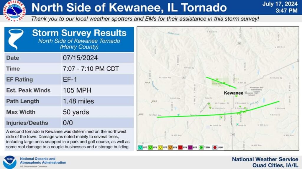
But a second EF-1 tornado has been confirmed on Wednesday to have occurred earlier from 7:07 to 7:10 p.m. with a path length of 1.48 miles and a width of 50 yards. Peak winds were clocked at 105 mph. That tornado was determined to be on the northwest side of town and was the weather event responsible for damage to the Baker Park Golf Course, several roofs, damage to a couple businesses and a storage building.
The Enhanced Fujita scale rates tornado intensity based on the severity of the damage they cause. EF-1 are tornadoes that range from 86-110 mph and cause moderate damage.